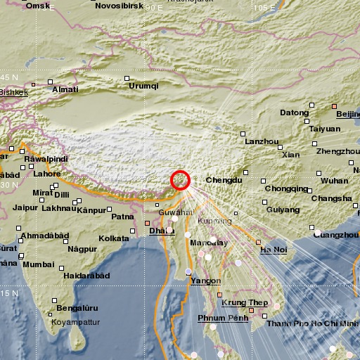
Eastern Xizang-India Border Reg.
17/11/2017 22:34:26 (UTC) M 6.5 49 Km

Localisation
- Eastern Xizang-India Border Reg.
- Latitude : 29.68 °N
- Longitude : 94.97 °E
- Depth : 49 Km
Description
- Date : 17/11/2017 22:34:26 (UTC)
- Magnitude : 6.5 M
- Phase count : 145
- RMS residual :1.15
Distance to nearest cities
- 169 kms of Along
- 182 kms of Pâsighât
- 228 kms of Tezu
- 241 kms of Dum Duma
- 243 kms of Dibrugarh
- 245 kms of Tinsukia

