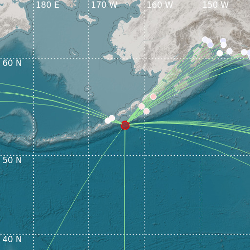
Unimak Island Region, Alaska
12/09/2021 17:03:10 (UTC) mb 4.7 21 Km

Localisation
- Unimak Island Region, Alaska
- Latitude : 53.42 °N
- Longitude : 163.49 °W
- Depth : 21 Km
Description
- Date : 12/09/2021 17:03:10 (UTC)
- Magnitude : 4.7 mb
- Phase count : 35
- RMS residual :0.55
Distance to nearest cities
- 826 kms of Bethel
- 847 kms of Kodiak
- 1005 kms of Homer
- 1185 kms of Anchorage
- 1192 kms of Elmendorf Air Force Base
- 1197 kms of Fort Richardson

