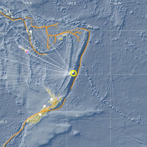
Kermadec Islands, New Zealand
23/05/2017 07:02:33 (UTC) mb 5 221 Km

Localisation
- Kermadec Islands, New Zealand
- Latitude : 29.64 °S
- Longitude : 177.66 °O
- Profondeur : 221 Km
Description
- Date : 23/05/2017 07:02:33 (UTC)
- Magnitude : 5 mb
- Nombre de phases : 62
- RMS résiduel :1.36
Distances des villes les plus proches
- 49 Km de Raoul island
- 976 Km de Nuku'alofa
- 1010 Km de Whangarei
- 1049 Km de Whakatane
- 1062 Km de Tauranga
- 1063 Km de North Shore

