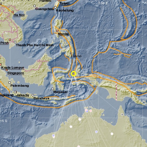
Northern Molucca Sea
21/11/2014 12:44:16 (UTC) mb 4.5 165 Km

Localisation
- Northern Molucca Sea
- Latitude : 0.1 °N
- Longitude : 126.52 °E
- Profondeur : 165 Km
Description
- Date : 21/11/2014 12:44:16 (UTC)
- Magnitude : 4.5 mb
- Nombre de phases : 23
- RMS résiduel :0.96
Distances des villes les plus proches
- 121 Km de Ternate
- 211 Km de Bitung
- 233 Km de Tomohon
- 243 Km de Manado
- 284 Km de Mobagu
- 388 Km de Gorontalo

